
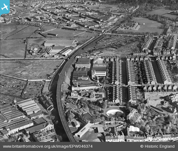
EPW046374 ENGLAND (1934). Alvis Motor Car and Engineering Works and the Coventry Corporation Water Works, Spon End, 1934
© Hawlfraint cyfranwyr OpenStreetMap a thrwyddedwyd gan yr OpenStreetMap Foundation. 2024. Trwyddedir y gartograffeg fel CC BY-SA.
Delweddau cyfagos (28)
EPW046374

EPW044456

EPW046379

EPW046373

EPW046378

EPW051465

EPW053106

EPW051466

EPW051457

EPW051463

EPW051464

EPW044455

EPW051455

EPW051467

EPW051462

EPW051459

EPW051456

EPW051460

EPW044453

EPW046375

EPW044457

EPW046376

EPW044454

EPW051461

EPW051454

EPW044451

EPW046377

EPW044452

Manylion
| Pennawd | [EPW046374] Alvis Motor Car and Engineering Works and the Coventry Corporation Water Works, Spon End, 1934 |
| Cyfeirnod | EPW046374 |
| Dyddiad | October-1934 |
| Dolen | |
| Enw lle | SPON END |
| Plwyf | |
| Ardal | |
| Gwlad | ENGLAND |
| Dwyreiniad / Gogleddiad | 432354, 279308 |
| Hydred / Lledred | -1.5243051150419, 52.410439226269 |
| Cyfeirnod Grid Cenedlaethol | SP324793 |
Pinnau
 Darren |
Saturday 20th of April 2019 01:38:18 AM | |
Darren |
Saturday 20th of April 2019 01:37:07 AM | |
JG |
Wednesday 15th of May 2013 10:30:58 AM | |
JG |
Wednesday 15th of May 2013 10:30:34 AM | |
JG |
Wednesday 15th of May 2013 10:29:38 AM | |
JG |
Wednesday 15th of May 2013 10:27:20 AM | |
JG |
Wednesday 15th of May 2013 10:26:38 AM | |
JG |
Wednesday 15th of May 2013 10:26:11 AM | |
JG |
Wednesday 15th of May 2013 10:25:10 AM | |
JG |
Wednesday 15th of May 2013 10:24:37 AM | |
JG |
Wednesday 15th of May 2013 10:23:49 AM |


