
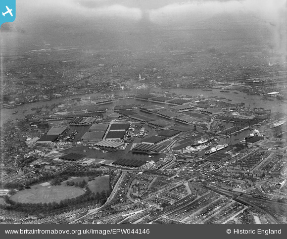
EPW044146 ENGLAND (1934). Surrey Commercial Docks, Rotherhithe, from the south-west, 1934
© Hawlfraint cyfranwyr OpenStreetMap a thrwyddedwyd gan yr OpenStreetMap Foundation. 2024. Trwyddedir y gartograffeg fel CC BY-SA.
Delweddau cyfagos (6)
EPW044146

EPW060454

EPW044142

EAW164220

EPW035613

EPW036263

Manylion
| Pennawd | [EPW044146] Surrey Commercial Docks, Rotherhithe, from the south-west, 1934 |
| Cyfeirnod | EPW044146 |
| Dyddiad | May-1934 |
| Dolen | |
| Enw lle | ROTHERHITHE |
| Plwyf | |
| Ardal | |
| Gwlad | ENGLAND |
| Dwyreiniad / Gogleddiad | 535708, 179044 |
| Hydred / Lledred | -0.044915700386752, 51.493546232001 |
| Cyfeirnod Grid Cenedlaethol | TQ357790 |
Pinnau

Cyfraniadau Grŵp
 St. Anne's Church, Limehouse, 30/09/2014 |
 Class31 |
Sunday 5th of October 2014 02:42:07 PM |


