
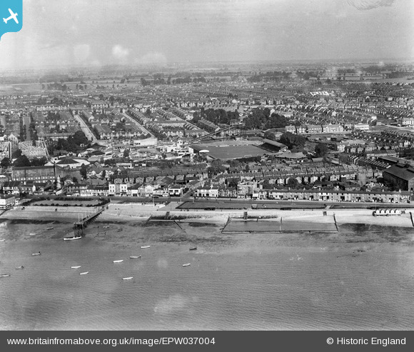
EPW037004 ENGLAND (1931). The Kursaal and environs, Southend-on-Sea, from the south-west, 1931
© Hawlfraint cyfranwyr OpenStreetMap a thrwyddedwyd gan yr OpenStreetMap Foundation. 2024. Trwyddedir y gartograffeg fel CC BY-SA.
Delweddau cyfagos (18)
EPW037004

EPW040962

EPW037003

EPW040961

EPW024887

EAW024660

EPW036736

EPW040965

EAW053086

EPW000444

EPW036995

EPW058226

EPW036726

EPW062745

EAW002219

EPW036730

EPW058224

EPW000443

Manylion
| Pennawd | [EPW037004] The Kursaal and environs, Southend-on-Sea, from the south-west, 1931 |
| Cyfeirnod | EPW037004 |
| Dyddiad | October-1931 |
| Dolen | |
| Enw lle | SOUTHEND-ON-SEA |
| Plwyf | |
| Ardal | |
| Gwlad | ENGLAND |
| Dwyreiniad / Gogleddiad | 589215, 184847 |
| Hydred / Lledred | 0.72824373096496, 51.530297821464 |
| Cyfeirnod Grid Cenedlaethol | TQ892848 |


