
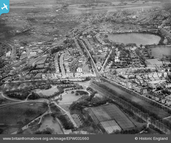
EPW031660 ENGLAND (1930). Finsbury Park and Seven Sisters Road, Finsbury Park, from the south-west, 1930
© Hawlfraint cyfranwyr OpenStreetMap a thrwyddedwyd gan yr OpenStreetMap Foundation. 2024. Trwyddedir y gartograffeg fel CC BY-SA.
Delweddau cyfagos (7)
EPW031660

EPW031663

EPW031504

EPW031501

EPW031664

EPW031665

EAW044323

Manylion
| Pennawd | [EPW031660] Finsbury Park and Seven Sisters Road, Finsbury Park, from the south-west, 1930 |
| Cyfeirnod | EPW031660 |
| Dyddiad | April-1930 |
| Dolen | |
| Enw lle | FINSBURY PARK |
| Plwyf | |
| Ardal | |
| Gwlad | ENGLAND |
| Dwyreiniad / Gogleddiad | 531874, 187445 |
| Hydred / Lledred | -0.096970533913595, 51.569957689918 |
| Cyfeirnod Grid Cenedlaethol | TQ319874 |
Pinnau
 billyfern |
Monday 30th of June 2014 12:15:28 AM | |
billyfern |
Monday 30th of June 2014 12:14:53 AM | |
billyfern |
Monday 30th of June 2014 12:14:28 AM | |
billyfern |
Monday 30th of June 2014 12:13:34 AM | |
billyfern |
Monday 30th of June 2014 12:13:06 AM | |
billyfern |
Monday 30th of June 2014 12:12:35 AM | |
billyfern |
Monday 30th of June 2014 12:12:04 AM | |
billyfern |
Monday 30th of June 2014 12:11:48 AM | |
billyfern |
Monday 30th of June 2014 12:11:32 AM | |
billyfern |
Monday 30th of June 2014 12:11:13 AM |


