
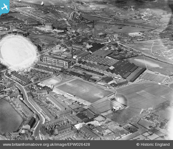
EPW026428 ENGLAND (1929). The Leyland Football Ground, Leyland Motor Works and surroundings, Leyland, 1929. This image has been produced from a damaged negative.
© Hawlfraint cyfranwyr OpenStreetMap a thrwyddedwyd gan yr OpenStreetMap Foundation. 2024. Trwyddedir y gartograffeg fel CC BY-SA.
Delweddau cyfagos (7)
EPW026428

EPW038856

EPW038855

EPW038851

EPW038849

EPW038850

EPW026417

Manylion
| Pennawd | [EPW026428] The Leyland Football Ground, Leyland Motor Works and surroundings, Leyland, 1929. This image has been produced from a damaged negative. |
| Cyfeirnod | EPW026428 |
| Dyddiad | April-1929 |
| Dolen | |
| Enw lle | LEYLAND |
| Plwyf | |
| Ardal | |
| Gwlad | ENGLAND |
| Dwyreiniad / Gogleddiad | 354299, 422129 |
| Hydred / Lledred | -2.6921934457879, 53.693376762503 |
| Cyfeirnod Grid Cenedlaethol | SD543221 |
Pinnau
 Sparky |
Thursday 28th of September 2017 09:38:11 PM | |
Ray |
Wednesday 30th of August 2017 05:08:46 PM | |
Ray |
Wednesday 30th of August 2017 05:08:20 PM | |
Ray |
Wednesday 30th of August 2017 05:08:04 PM | |
Ray |
Wednesday 30th of August 2017 05:07:42 PM | |
Ray |
Wednesday 30th of August 2017 05:06:51 PM | |
Ray |
Wednesday 30th of August 2017 05:04:47 PM | |
Ray |
Wednesday 30th of August 2017 05:04:12 PM | |
Ray |
Wednesday 30th of August 2017 05:03:38 PM | |
Ray |
Wednesday 30th of August 2017 05:03:17 PM | |
Ray |
Wednesday 30th of August 2017 05:02:43 PM |


