
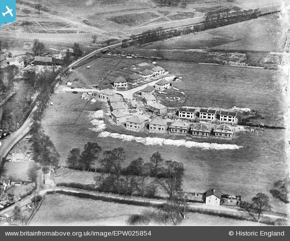
EPW025854 ENGLAND (1929). Housing along Belvue Road and Sandringham Road under construction with Northolt Park Racecourse in the distance, Northolt, 1929
© Hawlfraint cyfranwyr OpenStreetMap a thrwyddedwyd gan yr OpenStreetMap Foundation. 2024. Trwyddedir y gartograffeg fel CC BY-SA.
Delweddau cyfagos (12)
EPW025854

EPW025859

EPW025852

EPW025857

EPW025856

EPW025858

EPW025855

EPW025860

EPW025853

EPW025851

EPW025861

EPW035056

Manylion
| Pennawd | [EPW025854] Housing along Belvue Road and Sandringham Road under construction with Northolt Park Racecourse in the distance, Northolt, 1929 |
| Cyfeirnod | EPW025854 |
| Dyddiad | March-1929 |
| Dolen | |
| Enw lle | NORTHOLT |
| Plwyf | |
| Ardal | |
| Gwlad | ENGLAND |
| Dwyreiniad / Gogleddiad | 513270, 184302 |
| Hydred / Lledred | -0.36632418959641, 51.545751443599 |
| Cyfeirnod Grid Cenedlaethol | TQ133843 |
Pinnau
 Class31 |
Friday 28th of September 2012 06:28:26 PM | |
Class31 |
Friday 28th of September 2012 06:20:42 PM | |
Class31 |
Friday 28th of September 2012 06:19:33 PM | |
Class31 |
Friday 28th of September 2012 06:18:39 PM | |
Class31 |
Friday 28th of September 2012 06:18:10 PM |


