
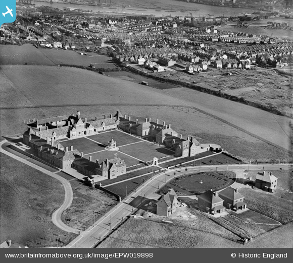
EPW019898 ENGLAND (1927). Foord Almshouses, Borstal, 1927
© Hawlfraint cyfranwyr OpenStreetMap a thrwyddedwyd gan yr OpenStreetMap Foundation. 2024. Trwyddedir y gartograffeg fel CC BY-SA.
Delweddau cyfagos (4)
EPW019898

EPW019899

EPW019897

EPW019896

Manylion
| Pennawd | [EPW019898] Foord Almshouses, Borstal, 1927 |
| Cyfeirnod | EPW019898 |
| Dyddiad | October-1927 |
| Dolen | |
| Enw lle | BORSTAL |
| Plwyf | |
| Ardal | |
| Gwlad | ENGLAND |
| Dwyreiniad / Gogleddiad | 573748, 167128 |
| Hydred / Lledred | 0.49676347475442, 51.376082354738 |
| Cyfeirnod Grid Cenedlaethol | TQ737671 |
Pinnau
 32110 |
Monday 7th of August 2017 12:28:44 PM | |
rosiegoddard |
Friday 9th of January 2015 07:26:03 PM | |
 Dylan Moore |
Friday 8th of March 2013 03:00:14 PM | |
Switches |
Wednesday 29th of August 2012 05:19:24 PM | |
I don't think so. I live in the house which garden looks down onto it. We are opposite the first of the terraced houses on Cornwall Road, which are further along than this building. I think there is another building further down (further left in this picture) that is more likely to be the club. |
rosiegoddard |
Friday 9th of January 2015 07:25:07 PM |
Switches |
Tuesday 28th of August 2012 05:18:11 PM | |
Switches |
Monday 27th of August 2012 09:10:26 PM |
Cyfraniadau Grŵp
http://www.britainfromabove.org.uk/sites/all/lib/aerofilms-images/zoomify/england/EPW062150/TileGroup0/2-1-0.jpg |
Switches |
Wednesday 30th of April 2014 01:37:01 PM |
 This is very near to where I used to live in Rochester, not so many fields there now though! |
Verity Hancock |
Monday 10th of June 2013 10:53:21 PM |
 And here it is today! |
Verity Hancock |
Monday 10th of June 2013 01:24:22 PM |
You have an amazing flight control system for your knitted plane! |
David Parry |
Monday 10th of June 2013 10:53:21 PM |


