
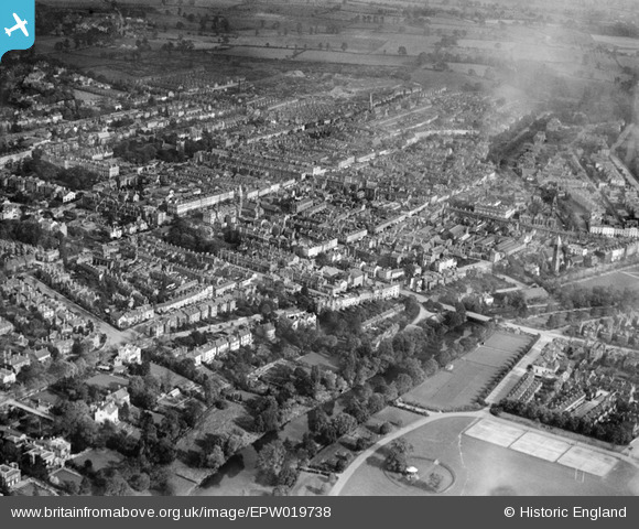
EPW019738 ENGLAND (1927). The town centre, Royal Leamington Spa, from the south-west, 1927
© Hawlfraint cyfranwyr OpenStreetMap a thrwyddedwyd gan yr OpenStreetMap Foundation. 2024. Trwyddedir y gartograffeg fel CC BY-SA.
Delweddau cyfagos (7)
EPW019738

EPW005090

EPW039094

EPW019736

EPW000415

EPW039093

EPW000414

Manylion
| Pennawd | [EPW019738] The town centre, Royal Leamington Spa, from the south-west, 1927 |
| Cyfeirnod | EPW019738 |
| Dyddiad | October-1927 |
| Dolen | |
| Enw lle | ROYAL LEAMINGTON SPA |
| Plwyf | ROYAL LEAMINGTON SPA |
| Ardal | |
| Gwlad | ENGLAND |
| Dwyreiniad / Gogleddiad | 431345, 265787 |
| Hydred / Lledred | -1.540402278246, 52.288931804688 |
| Cyfeirnod Grid Cenedlaethol | SP313658 |
Pinnau
 Glassman |
Friday 30th of August 2013 09:00:11 AM | |
Glassman |
Thursday 22nd of August 2013 01:32:19 PM | |
Glassman |
Thursday 22nd of August 2013 01:22:26 PM | |
Glassman |
Thursday 22nd of August 2013 01:17:12 PM | |
Nat |
Sunday 11th of November 2012 09:34:01 PM | |
Nat |
Sunday 11th of November 2012 09:33:44 PM |


