
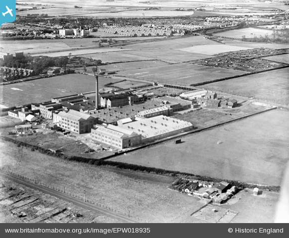
EPW018935 ENGLAND (1927). Jacob's Biscuit Factory, Walton, 1927
© Hawlfraint cyfranwyr OpenStreetMap a thrwyddedwyd gan yr OpenStreetMap Foundation. 2024. Trwyddedir y gartograffeg fel CC BY-SA.
Delweddau cyfagos (24)
EPW018935

EAW046702

EAW046695

EPW042684

EAW046699

EPW042685

EPR000616

EAW046701

EAW046705

EPW042682

EAW046704

EAW046694

EAW046706

EAW004624

EAW046696

EAW046703

EAW046697

EPW042683

EAW046698

EAW004627

EPW057887

EAW046700

EAW005650

EAW004626

Manylion
| Pennawd | [EPW018935] Jacob's Biscuit Factory, Walton, 1927 |
| Cyfeirnod | EPW018935 |
| Dyddiad | July-1927 |
| Dolen | |
| Enw lle | WALTON |
| Plwyf | |
| Ardal | |
| Gwlad | ENGLAND |
| Dwyreiniad / Gogleddiad | 336980, 396063 |
| Hydred / Lledred | -2.9492125482742, 53.457289984912 |
| Cyfeirnod Grid Cenedlaethol | SJ370961 |
Pinnau
 Barbara |
Wednesday 27th of June 2012 03:33:36 PM | |
Barbara |
Tuesday 26th of June 2012 02:32:08 PM | |
Barbara |
Tuesday 26th of June 2012 02:29:39 PM | |
Barbara |
Tuesday 26th of June 2012 02:28:28 PM | |
Barbara |
Tuesday 26th of June 2012 02:23:11 PM | |
88mph |
Tuesday 26th of June 2012 12:20:30 AM | |
88mph |
Tuesday 26th of June 2012 12:15:05 AM | |
88mph |
Tuesday 26th of June 2012 12:13:07 AM | |
88mph |
Tuesday 26th of June 2012 12:12:02 AM |
Cyfraniadau Grŵp
The area on the opposite side of Long Lane to Hartley's Village, so beyond it in this picture, became the site for the Schweppes factory from the 1950s, now closed. |
Barbara |
Wednesday 27th of June 2012 07:16:39 AM |


