
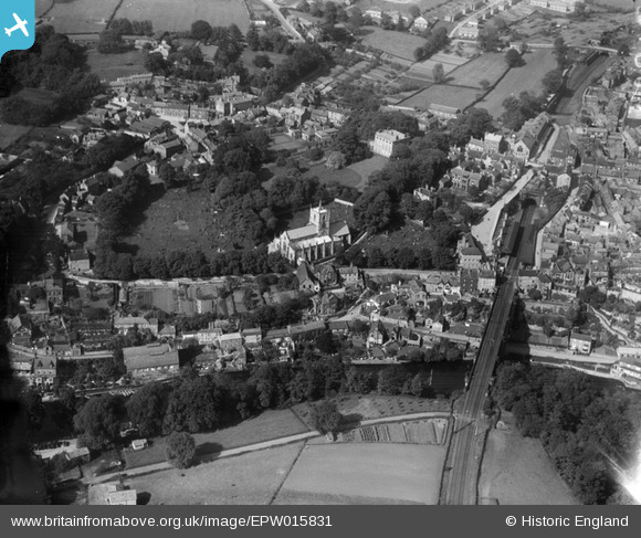
EPW015831 ENGLAND (1926). St John the Baptist Church and environs, Knaresborough, 1926
© Hawlfraint cyfranwyr OpenStreetMap a thrwyddedwyd gan yr OpenStreetMap Foundation. 2024. Trwyddedir y gartograffeg fel CC BY-SA.
Delweddau cyfagos (8)
EPW015831

EAW025644

EAW025642

EAW025641

EAW025647

EAW025643

EPW015827

EPW015830

Manylion
| Pennawd | [EPW015831] St John the Baptist Church and environs, Knaresborough, 1926 |
| Cyfeirnod | EPW015831 |
| Dyddiad | 5-June-1926 |
| Dolen | |
| Enw lle | KNARESBOROUGH |
| Plwyf | KNARESBOROUGH |
| Ardal | |
| Gwlad | ENGLAND |
| Dwyreiniad / Gogleddiad | 434699, 457177 |
| Hydred / Lledred | -1.4704738066807, 54.009254441472 |
| Cyfeirnod Grid Cenedlaethol | SE347572 |
Pinnau
 MattG |
Sunday 4th of December 2016 10:36:00 PM | |
aoxomoxoa |
Saturday 4th of October 2014 02:07:06 PM | |
aoxomoxoa |
Saturday 4th of October 2014 02:04:45 PM | |
aoxomoxoa |
Saturday 4th of October 2014 02:02:54 PM | |
aoxomoxoa |
Saturday 4th of October 2014 02:01:50 PM | |
MB |
Saturday 29th of September 2012 11:56:43 PM | |
On another photo: 'Knaresborough Hospital', they are clearly coal drops. |
Philip |
Saturday 6th of December 2014 05:41:59 AM |
 Class31 |
Monday 16th of July 2012 04:17:44 PM | |
Class31 |
Monday 16th of July 2012 04:15:21 PM | |
Class31 |
Monday 16th of July 2012 04:14:49 PM | |
Class31 |
Monday 16th of July 2012 04:12:12 PM | |
Class31 |
Monday 16th of July 2012 04:11:55 PM |


