
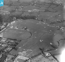
EPW015028 ENGLAND (1926). The golf course and cricket ground, Walsall, 1926

© Hawlfraint cyfranwyr OpenStreetMap a thrwyddedwyd gan yr OpenStreetMap Foundation. 2024. Trwyddedir y gartograffeg fel CC BY-SA.
Manylion
| Pennawd | [EPW015028] The golf course and cricket ground, Walsall, 1926 |
| Cyfeirnod | EPW015028 |
| Dyddiad | 12-April-1926 |
| Dolen | |
| Enw lle | WALSALL |
| Plwyf | |
| Ardal | |
| Gwlad | ENGLAND |
| Dwyreiniad / Gogleddiad | 402129, 297154 |
| Hydred / Lledred | -1.9685829905536, 52.571845165534 |
| Cyfeirnod Grid Cenedlaethol | SP021972 |
Pinnau
 John Llewellyn |
Monday 30th of November 2015 02:18:11 PM | |
Sandwell Street Kid |
Thursday 22nd of May 2014 02:14:22 PM | |
Sandwell Street Kid |
Thursday 22nd of May 2014 02:12:13 PM | |
Sandwell Street Kid |
Thursday 22nd of May 2014 02:10:38 PM | |
Sandwell Street Kid |
Tuesday 29th of April 2014 08:00:19 PM | |
Sandwell Street Kid |
Tuesday 29th of April 2014 07:51:36 PM | |
Sandwell Street Kid |
Tuesday 29th of April 2014 07:49:53 PM | |
Sandwell Street Kid |
Tuesday 29th of April 2014 07:49:18 PM | |
Sandwell Street Kid |
Tuesday 29th of April 2014 07:47:23 PM | |
Sandwell Street Kid |
Tuesday 29th of April 2014 07:46:18 PM | |
Sandwell Street Kid |
Tuesday 29th of April 2014 07:44:18 PM |
Cyfraniadau Grŵp
 Now I know what my mother meant when she used to say "we used to stroll over the golf links". Not strictly accurate as the course wasn't a links course, but I know what you meant Mom! |
Sandwell Street Kid |
Tuesday 29th of April 2014 07:43:53 PM |


