
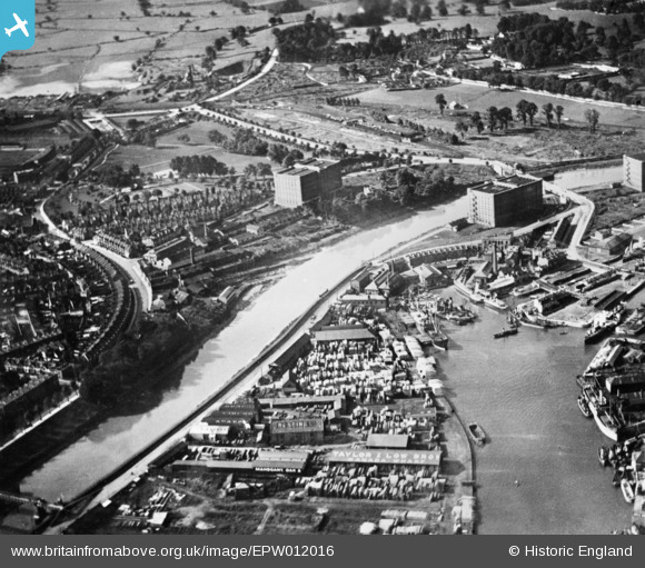
EPW012016 ENGLAND (1924). The River Avon at Ashton Gate, Bristol, 1924. This image has been produced from a copy-negative.
© Hawlfraint cyfranwyr OpenStreetMap a thrwyddedwyd gan yr OpenStreetMap Foundation. 2024. Trwyddedir y gartograffeg fel CC BY-SA.
Delweddau cyfagos (7)
EPW012016

EPW012015

EPW005470

EPW033497

EAW002051

EPW032528

EAW033326

Manylion
| Pennawd | [EPW012016] The River Avon at Ashton Gate, Bristol, 1924. This image has been produced from a copy-negative. |
| Cyfeirnod | EPW012016 |
| Dyddiad | September-1924 |
| Dolen | |
| Enw lle | BRISTOL |
| Plwyf | |
| Ardal | |
| Gwlad | ENGLAND |
| Dwyreiniad / Gogleddiad | 357300, 172058 |
| Hydred / Lledred | -2.61448867545, 51.445410029769 |
| Cyfeirnod Grid Cenedlaethol | ST573721 |
Pinnau
 MB |
Saturday 3rd of September 2016 01:56:30 PM | |
MB |
Saturday 3rd of September 2016 01:53:31 PM | |
MB |
Saturday 3rd of September 2016 01:53:02 PM | |
MB |
Saturday 3rd of September 2016 01:52:07 PM | |
MB |
Saturday 3rd of September 2016 01:50:56 PM | |
MB |
Saturday 3rd of September 2016 01:49:39 PM | |
Kevdrev |
Wednesday 27th of April 2016 02:58:43 AM | |
Kevdrev |
Wednesday 27th of April 2016 02:56:57 AM |


