
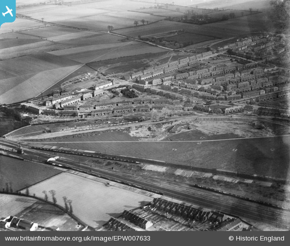
EPW007633 ENGLAND (1922). A new housing development under construction near Chadwell Heath Railway Station, Goodmayes, from the north-west, 1922
© Hawlfraint cyfranwyr OpenStreetMap a thrwyddedwyd gan yr OpenStreetMap Foundation. 2024. Trwyddedir y gartograffeg fel CC BY-SA.
Delweddau cyfagos (3)
EPW007633

EPW007631

EPW007630

Manylion
| Pennawd | [EPW007633] A new housing development under construction near Chadwell Heath Railway Station, Goodmayes, from the north-west, 1922 |
| Cyfeirnod | EPW007633 |
| Dyddiad | 23-March-1922 |
| Dolen | |
| Enw lle | GOODMAYES |
| Plwyf | |
| Ardal | |
| Gwlad | ENGLAND |
| Dwyreiniad / Gogleddiad | 547249, 187459 |
| Hydred / Lledred | 0.12475116235341, 51.566277494612 |
| Cyfeirnod Grid Cenedlaethol | TQ472875 |
Pinnau
 GRP47 |
Tuesday 1st of June 2021 02:46:31 PM | |
rac |
Thursday 7th of August 2014 09:02:59 PM | |
rac |
Sunday 3rd of August 2014 06:52:18 PM | |
rac |
Sunday 3rd of August 2014 06:50:10 PM | |
rac |
Sunday 3rd of August 2014 09:13:04 AM | |
rac |
Sunday 3rd of August 2014 09:12:25 AM |
Cyfraniadau Grŵp
Chadwell Heath, Mayfield Road area |
John |
Monday 2nd of July 2012 03:03:10 PM |
Dear all, That’s great; we’ve reviewed your comments and thanks to your help we can update the catalogue. The revised record will appear here in due course. Katy Whitaker Britain from Above Cataloguer |
Katy Whitaker |
Monday 2nd of July 2012 03:03:10 PM |
I don't know where it is but it clearly relates to photo; EPW007632. |
TheBlueCube |
Friday 29th of June 2012 09:50:38 AM |


