
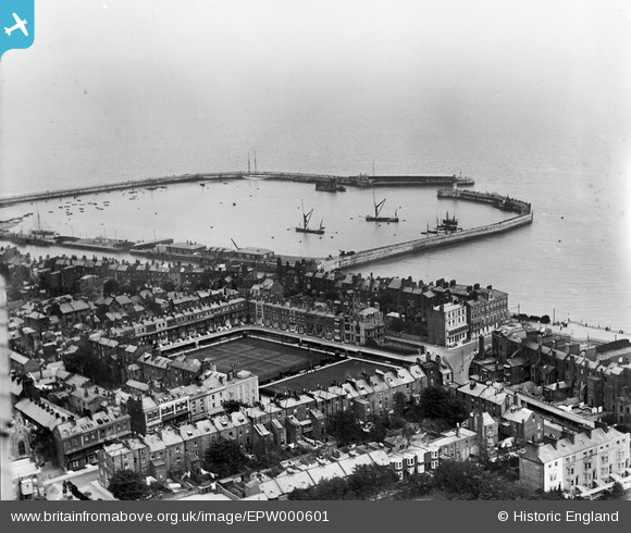
EPW000601 ENGLAND (1920). The Royal Harbour, Ramsgate, from the north-west, 1920
© Hawlfraint cyfranwyr OpenStreetMap a thrwyddedwyd gan yr OpenStreetMap Foundation. 2024. Trwyddedir y gartograffeg fel CC BY-SA.
Delweddau cyfagos (10)
EPW000601

EPW013301

EPW000081

EAW009024

EPW000094

EPW035451

EAW009023

EPW000090

EPW000097

EPW052895

Manylion
| Pennawd | [EPW000601] The Royal Harbour, Ramsgate, from the north-west, 1920 |
| Cyfeirnod | EPW000601 |
| Dyddiad | April-1920 |
| Dolen | |
| Enw lle | RAMSGATE |
| Plwyf | RAMSGATE |
| Ardal | |
| Gwlad | ENGLAND |
| Dwyreiniad / Gogleddiad | 637909, 164501 |
| Hydred / Lledred | 1.4154796299563, 51.329249838354 |
| Cyfeirnod Grid Cenedlaethol | TR379645 |
Pinnau
 Gen_Hancock |
Thursday 9th of February 2017 01:07:50 PM | |
Gen_Hancock |
Thursday 9th of February 2017 01:04:08 PM | |
Gen_Hancock |
Thursday 9th of February 2017 01:00:23 PM | |
Gen_Hancock |
Thursday 9th of February 2017 12:47:35 PM | |
Gen_Hancock |
Thursday 9th of February 2017 12:45:36 PM | |
Gen_Hancock |
Thursday 9th of February 2017 12:43:15 PM | |
Gen_Hancock |
Thursday 9th of February 2017 12:40:54 PM |
Cyfraniadau Grŵp
 Ramsgate Harbour |
 Alan McFaden |
Wednesday 10th of December 2014 02:43:18 PM |


