
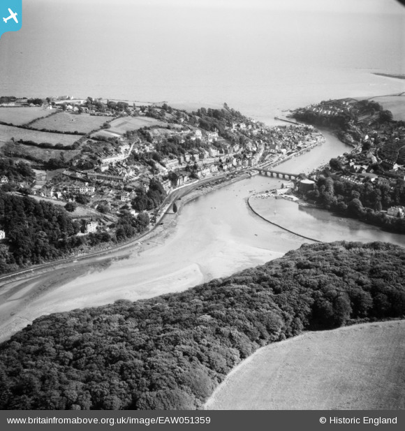
EAW051359 ENGLAND (1953). The confluence of the East Looe and West Looe Rivers and the town, Looe, 1953
© Hawlfraint cyfranwyr OpenStreetMap a thrwyddedwyd gan yr OpenStreetMap Foundation. 2024. Trwyddedir y gartograffeg fel CC BY-SA.
Delweddau cyfagos (3)
EAW051359

EPW033110

EPW033056

Manylion
| Pennawd | [EAW051359] The confluence of the East Looe and West Looe Rivers and the town, Looe, 1953 |
| Cyfeirnod | EAW051359 |
| Dyddiad | 11-August-1953 |
| Dolen | |
| Enw lle | LOOE |
| Plwyf | LOOE |
| Ardal | |
| Gwlad | ENGLAND |
| Dwyreiniad / Gogleddiad | 225393, 53817 |
| Hydred / Lledred | -4.4549980043385, 50.357715160938 |
| Cyfeirnod Grid Cenedlaethol | SX254538 |
Pinnau
 redmist |
Wednesday 16th of December 2020 09:53:34 AM |


