
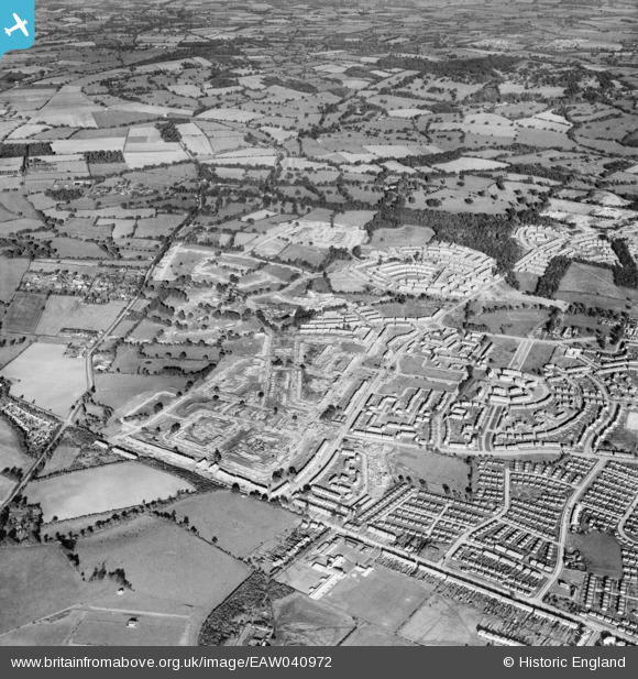
EAW040972 ENGLAND (1951). Construction of the Harold Hill Estate, Harold Hill, 1951
© Hawlfraint cyfranwyr OpenStreetMap a thrwyddedwyd gan yr OpenStreetMap Foundation. 2024. Trwyddedir y gartograffeg fel CC BY-SA.
Manylion
| Pennawd | [EAW040972] Construction of the Harold Hill Estate, Harold Hill, 1951 |
| Cyfeirnod | EAW040972 |
| Dyddiad | 23-October-1951 |
| Dolen | |
| Enw lle | HAROLD HILL |
| Plwyf | |
| Ardal | |
| Gwlad | ENGLAND |
| Dwyreiniad / Gogleddiad | 553789, 192518 |
| Hydred / Lledred | 0.22126326446492, 51.609989883366 |
| Cyfeirnod Grid Cenedlaethol | TQ538925 |
Pinnau
 jonnyace |
Friday 29th of December 2023 11:03:15 PM | |
jonnyace |
Friday 29th of December 2023 11:02:41 PM | |
jonnyace |
Friday 29th of December 2023 11:01:39 PM | |
jonnyace |
Friday 29th of December 2023 11:00:38 PM | |
jonnyace |
Friday 29th of December 2023 11:00:05 PM | |
jonnyace |
Friday 29th of December 2023 10:59:14 PM | |
jonnyace |
Friday 29th of December 2023 10:57:17 PM | |
jonnyace |
Friday 29th of December 2023 10:55:34 PM | |
jonnyace |
Friday 29th of December 2023 10:53:18 PM | |
jonnyace |
Friday 29th of December 2023 10:50:42 PM | |
jonnyace |
Friday 29th of December 2023 10:47:15 PM | |
Post-war prefabs |
Saturday 2nd of November 2019 08:17:11 AM | |
steman74 |
Monday 28th of November 2016 08:46:12 AM | |
steman74 |
Monday 28th of November 2016 08:45:02 AM |


