
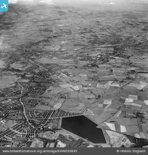
EAW039843 ENGLAND (1951). Heaton Park Reservoir and the town, Whitefield, from the south-east, 1951
© Hawlfraint cyfranwyr OpenStreetMap a thrwyddedwyd gan yr OpenStreetMap Foundation. 2024. Trwyddedir y gartograffeg fel CC BY-SA.
Delweddau cyfagos (2)
EAW039843

EAW039837

Manylion
| Pennawd | [EAW039843] Heaton Park Reservoir and the town, Whitefield, from the south-east, 1951 |
| Cyfeirnod | EAW039843 |
| Dyddiad | 15-September-1951 |
| Dolen | |
| Enw lle | WHITEFIELD |
| Plwyf | |
| Ardal | |
| Gwlad | ENGLAND |
| Dwyreiniad / Gogleddiad | 382006, 405435 |
| Hydred / Lledred | -2.2715838169311, 53.545001178112 |
| Cyfeirnod Grid Cenedlaethol | SD820054 |
Pinnau
 Moonraker |
Thursday 25th of January 2024 10:14:23 PM | |
Moonraker |
Thursday 25th of January 2024 10:05:58 PM | |
Moonraker |
Thursday 25th of January 2024 10:04:42 PM | |
Moonraker |
Friday 1st of December 2023 04:13:59 PM | |
Moonraker |
Friday 1st of December 2023 04:11:14 PM | |
toecee |
Sunday 19th of September 2021 09:22:42 PM | |
toecee |
Sunday 19th of September 2021 09:19:47 PM | |
toecee |
Sunday 19th of September 2021 09:18:29 PM | |
toecee |
Sunday 19th of September 2021 09:16:52 PM | |
DMalone |
Tuesday 17th of April 2018 10:33:06 AM | |
DMalone |
Tuesday 17th of April 2018 10:30:50 AM | |
DMalone |
Tuesday 17th of April 2018 10:28:52 AM | |
DMalone |
Tuesday 17th of April 2018 10:28:11 AM | |
Barney Rubble |
Friday 29th of April 2016 11:04:15 PM | |
Sloopy |
Monday 28th of March 2016 01:44:56 PM | |
Sloopy |
Monday 28th of March 2016 01:36:07 PM | |
Eddie Ball |
Monday 15th of September 2014 02:26:32 PM | |
boltie |
Wednesday 7th of May 2014 12:13:25 AM | |
boltie |
Monday 5th of May 2014 08:53:19 AM | |
boltie |
Monday 5th of May 2014 08:51:36 AM |


