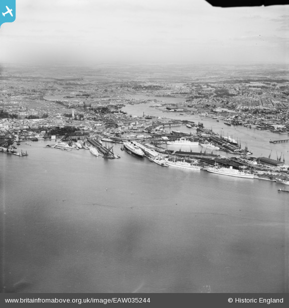
EAW035244 ENGLAND (1951). The docks and the city, Southampton, from the south-west, 1951
© Hawlfraint cyfranwyr OpenStreetMap a thrwyddedwyd gan yr OpenStreetMap Foundation. 2024. Trwyddedir y gartograffeg fel CC BY-SA.
Delweddau cyfagos (6)
EAW035244

EPW041039
 formation flying over Kingswood, Sanderstead, from the east, 1933")
EPW041069

EPW041067

EAW008812

EPW041066

Manylion
| Pennawd | [EAW035244] The docks and the city, Southampton, from the south-west, 1951 |
| Cyfeirnod | EAW035244 |
| Dyddiad | 6-April-1951 |
| Dolen | |
| Enw lle | SOUTHAMPTON |
| Plwyf | |
| Ardal | |
| Gwlad | ENGLAND |
| Dwyreiniad / Gogleddiad | 441690, 110525 |
| Hydred / Lledred | -1.4071822366104, 50.892148011382 |
| Cyfeirnod Grid Cenedlaethol | SU417105 |
Pinnau
 michael hooper |
Saturday 28th of March 2015 03:21:36 PM | |
 Class31 |
Saturday 31st of May 2014 07:29:58 AM |