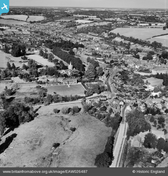
EAW026487 ENGLAND (1949). St Mary's Church and the town, Chesham, from the south-west, 1949

© Hawlfraint cyfranwyr OpenStreetMap a thrwyddedwyd gan yr OpenStreetMap Foundation. 2024. Trwyddedir y gartograffeg fel CC BY-SA.

Delweddau cyfagos (4)

EAW026487
  0° 0m
EAW026488
  104° 217m
EAW026486
  0° 238m
EPW018381
  42° 322m

Manylion

Pennawd [EAW026487] St Mary's Church and the town, Chesham, from the south-west, 1949
Cyfeirnod EAW026487
Dyddiad 10-September-1949
Dolen
Enw lle CHESHAM
Plwyf CHESHAM
Ardal
Gwlad ENGLAND
Dwyreiniad / Gogleddiad 495542, 201330
Hydred / Lledred -0.61727919613073, 51.702108922575
Cyfeirnod Grid Cenedlaethol SP955013

Pinnau

The Bury Grade 2 listed building - English Heritage Building ID: 43536 Country house built for William Lowndes (1652-1724) Secretary to the Treasury in the reign of Queen Anne. Date 1716 on rainwater heads. Original 5 bay front extended in late C18 to 7 bays. Wing added 1853. Neo-Georgian north garden arcade connecting house with summer house.

totoro
Thursday 27th of November 2014 09:54:20 PM
Church of St Mary (HP5 1JD) Grade 1 listed building -English Heritage Building ID: 43532 C13 nave and aisles, chancel arch widened. Mid C14 tower, chancel and south aisle rebuilt. C15 clerestorey and south porch. Considerably restored 1868-9 by G G Scott.

totoro
Thursday 27th of November 2014 09:45:57 PM
Water tower for steam trains - still standing.

totoro
Thursday 27th of November 2014 09:36:25 PM
Chesham Railway Station. A terminus station, the single line runs to the right for 5955 metres to Chalfont Road (Chalfont and Latimer, later Chalfont) where it meets the London-Aylesbury line. The first official service on the line left Chesham for London's Baker Street at 6.55 am on 8 July 1889. Railway traffic included the export of watercress and import of coal. Originally Metropolitan Railway the line passed to London Transport in 1933. By 2000 the station was the most Northern and the most Western on London Underground. It then passed to Transport for London.

totoro
Thursday 27th of November 2014 09:35:55 PM

totoro
Thursday 27th of November 2014 09:33:20 PM
The avenue elms were felled in 1950 as they were thought to have Dutch Elm Disease. Most of the trees, however, were found to have been healthy.

totoro
Thursday 27th of November 2014 09:31:24 PM
Skottowe's Pond The pond was created in the early 18th Century. Formerly reed edged the edge was concreted in the 1920s. About 120m x 40m with an island about 20m x 5m. The pond is named after the Skottowe family, who owned a mansion house, called Bury Hill House, which once stood in the area where the Guide Hut is now located. During World War One, the park was used for training soldiers in bridge construction across Skottowes Pond. The island was created in the 1920s. In 1953, the Lowndes family donated Lowndes Park to the Urban District Council. Grazing of cattle only ended in the park in 1959.

totoro
Thursday 27th of November 2014 09:30:35 PM