
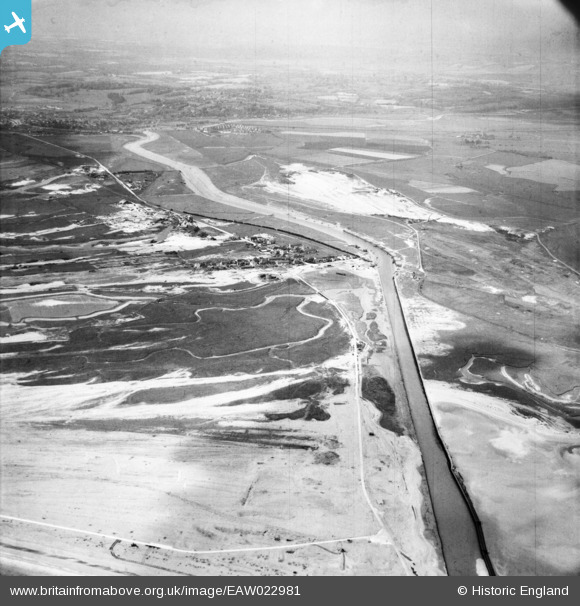
EAW022981 ENGLAND (1949). The River Rother, village and Northpoint Beach, Rye Harbour, from the south-east, 1949
© Hawlfraint cyfranwyr OpenStreetMap a thrwyddedwyd gan yr OpenStreetMap Foundation. 2024. Trwyddedir y gartograffeg fel CC BY-SA.
Delweddau cyfagos (2)
EAW022981

EPW026250

Manylion
| Pennawd | [EAW022981] The River Rother, village and Northpoint Beach, Rye Harbour, from the south-east, 1949 |
| Cyfeirnod | EAW022981 |
| Dyddiad | 6-May-1949 |
| Dolen | |
| Enw lle | RYE HARBOUR |
| Plwyf | ICKLESHAM |
| Ardal | |
| Gwlad | ENGLAND |
| Dwyreiniad / Gogleddiad | 594670, 118252 |
| Hydred / Lledred | 0.77061509639517, 50.930269636713 |
| Cyfeirnod Grid Cenedlaethol | TQ947183 |
Pinnau
Cyfraniadau Grŵp
 MG Emplacements, Rye. |
 cptpies |
Thursday 9th of April 2015 01:41:36 PM |


