
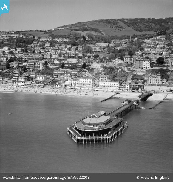
EAW022208 ENGLAND (1949). Royal Victoria Pier and the Esplanade, Ventnor, from the south-east, 1949
© Hawlfraint cyfranwyr OpenStreetMap a thrwyddedwyd gan yr OpenStreetMap Foundation. 2024. Trwyddedir y gartograffeg fel CC BY-SA.
Delweddau cyfagos (20)
EAW022208

EAW022210

EPW023096

EPW023097

EAW022207

EAW038594

EAW022209

EAW015243

EPW000505

EPW039656

EAW038592

EPW023099

EPW043010

EPW039654

EPW032286

EPW022979

EAW015242

EPW032287

EPW022977

EPW039653

Manylion
| Pennawd | [EAW022208] Royal Victoria Pier and the Esplanade, Ventnor, from the south-east, 1949 |
| Cyfeirnod | EAW022208 |
| Dyddiad | 17-April-1949 |
| Dolen | |
| Enw lle | VENTNOR |
| Plwyf | VENTNOR |
| Ardal | |
| Gwlad | ENGLAND |
| Dwyreiniad / Gogleddiad | 456327, 77151 |
| Hydred / Lledred | -1.2041714738204, 50.590779881101 |
| Cyfeirnod Grid Cenedlaethol | SZ563772 |
Pinnau
 Kentishman |
Monday 25th of July 2016 12:57:55 PM | |
 |
 Billy Turner |
Tuesday 8th of March 2016 03:58:51 PM |
Cyfraniadau Grŵp
 Pier split in two to prevent its use as an invasion landing stage. |
Kentishman |
Monday 25th of July 2016 01:02:06 PM |


