
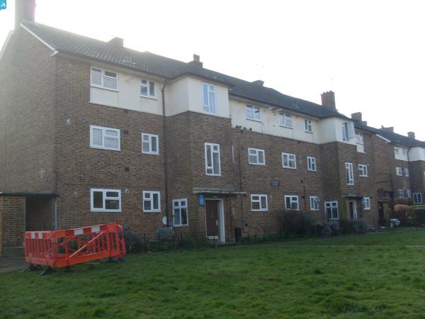
EAW020727 ENGLAND (1948). Collin's Hill and new housing development at St Paul's Wood Hill, St Paul's Cray, 1948

© Hawlfraint cyfranwyr OpenStreetMap a thrwyddedwyd gan yr OpenStreetMap Foundation. 2024. Trwyddedir y gartograffeg fel CC BY-SA.
Delweddau cyfagos (2)
EAW020727

EAW021757

Manylion
| Pennawd | [EAW020727] Collin's Hill and new housing development at St Paul's Wood Hill, St Paul's Cray, 1948 |
| Cyfeirnod | EAW020727 |
| Dyddiad | 24-December-1948 |
| Dolen | |
| Enw lle | ST PAUL'S CRAY |
| Plwyf | |
| Ardal | |
| Gwlad | ENGLAND |
| Dwyreiniad / Gogleddiad | 546020, 169581 |
| Hydred / Lledred | 0.099635041099857, 51.405937128365 |
| Cyfeirnod Grid Cenedlaethol | TQ460696 |
Pinnau
 Gone2Kent |
Sunday 2nd of March 2014 08:26:13 PM | |
Gone2Kent |
Sunday 2nd of March 2014 08:24:49 PM | |
Gone2Kent |
Sunday 2nd of March 2014 08:22:46 PM | |
Gone2Kent |
Sunday 9th of February 2014 01:57:28 PM | |
Gone2Kent |
Thursday 26th of December 2013 09:01:54 PM | |
Gone2Kent |
Thursday 26th of December 2013 08:58:24 PM | |
Gone2Kent |
Thursday 26th of December 2013 08:58:20 PM | |
cptpies |
Friday 20th of December 2013 10:26:38 AM |


Cyfraniadau Grŵp
 WWII Twin HAA Battery ZS5, St Paul's Cray. |
cptpies |
Friday 20th of December 2013 10:26:58 AM |


