
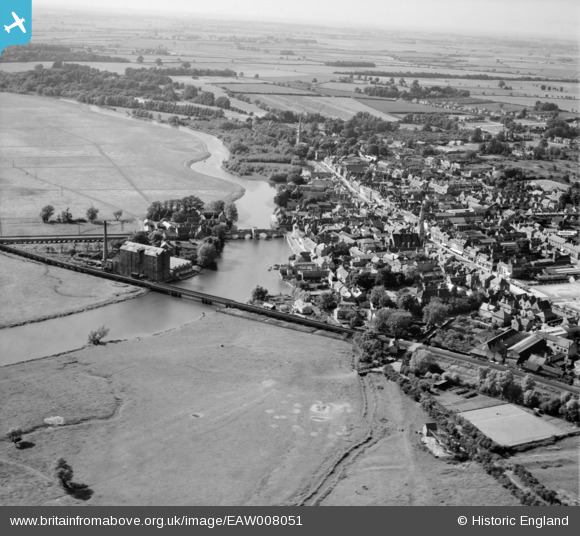
EAW008051 ENGLAND (1947). The road bridge, railway bridge and the town, St Ives, from the south-east, 1947
© Hawlfraint cyfranwyr OpenStreetMap a thrwyddedwyd gan yr OpenStreetMap Foundation. 2024. Trwyddedir y gartograffeg fel CC BY-SA.
Delweddau cyfagos (7)
EAW008051

EAW031905

EPW014450A

EPW028940

EPW028943

EPW028942

EPW028936

Manylion
| Pennawd | [EAW008051] The road bridge, railway bridge and the town, St Ives, from the south-east, 1947 |
| Cyfeirnod | EAW008051 |
| Dyddiad | 12-July-1947 |
| Dolen | |
| Enw lle | ST IVES |
| Plwyf | SAINT IVES |
| Ardal | |
| Gwlad | ENGLAND |
| Dwyreiniad / Gogleddiad | 531450, 270978 |
| Hydred / Lledred | -0.071138575181312, 52.320751839965 |
| Cyfeirnod Grid Cenedlaethol | TL315710 |
Pinnau
 mallard64 |
Thursday 6th of August 2020 10:44:36 PM | |
Graham Yaxley |
Tuesday 17th of February 2015 01:35:48 AM | |
MB |
Monday 11th of November 2013 09:44:31 AM | |
MB |
Monday 11th of November 2013 09:43:29 AM | |
MB |
Monday 11th of November 2013 09:42:55 AM |
Cyfraniadau Grŵp
 St Ledger's Chapel. Has been used as a private dwelling, toll booth and public house. |
Lynda Tubbs |
Thursday 28th of November 2013 07:18:19 PM |


