
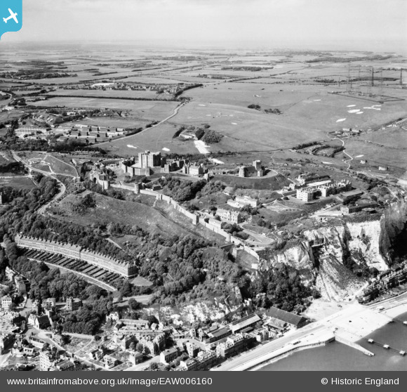
EAW006160 ENGLAND (1947). Dover Castle and environs, Dover, from the south-west, 1947
© Hawlfraint cyfranwyr OpenStreetMap a thrwyddedwyd gan yr OpenStreetMap Foundation. 2024. Trwyddedir y gartograffeg fel CC BY-SA.
Delweddau cyfagos (10)
EAW006160

EPW000347

EAW007608

EPW000349

EPW000574

EAW022988

EPW038153

EAW007609

EAW007617

EPW039372

Manylion
| Pennawd | [EAW006160] Dover Castle and environs, Dover, from the south-west, 1947 |
| Cyfeirnod | EAW006160 |
| Dyddiad | 27-May-1947 |
| Dolen | |
| Enw lle | DOVER |
| Plwyf | DOVER |
| Ardal | |
| Gwlad | ENGLAND |
| Dwyreiniad / Gogleddiad | 632470, 141587 |
| Hydred / Lledred | 1.3226761066961, 51.125783465268 |
| Cyfeirnod Grid Cenedlaethol | TR325416 |
Pinnau
 Matt Aldred edob.mattaldred.com |
Tuesday 16th of January 2024 01:22:48 PM | |
 Kizle7 |
Monday 9th of January 2023 01:44:01 AM | |
Kizle7 |
Monday 13th of September 2021 01:39:10 AM | |
Kizle7 |
Monday 13th of September 2021 01:37:31 AM | |
Kizle7 |
Monday 13th of September 2021 01:32:23 AM | |
Kizle7 |
Monday 13th of September 2021 01:28:33 AM | |
Stubzi34 |
Friday 21st of September 2018 08:45:41 PM | |
Stubzi34 |
Friday 21st of September 2018 08:06:26 PM | |
Stubzi34 |
Friday 21st of September 2018 08:04:00 PM | |
Stubzi34 |
Friday 21st of September 2018 07:56:53 PM | |
Stubzi34 |
Friday 21st of September 2018 07:44:10 PM | |
Stubzi34 |
Friday 21st of September 2018 07:38:27 PM | |
Stubzi34 |
Friday 21st of September 2018 07:36:54 PM | |
Stubzi34 |
Friday 21st of September 2018 04:46:33 PM | |
Stubzi34 |
Friday 21st of September 2018 04:42:32 PM | |
Stubzi34 |
Friday 21st of September 2018 04:39:04 PM | |
Stubzi34 |
Friday 21st of September 2018 04:26:28 PM | |
cptpies |
Tuesday 10th of October 2017 03:40:03 PM | |
jrussill |
Wednesday 8th of January 2014 06:28:20 PM | |
cptpies |
Thursday 28th of November 2013 10:27:56 AM | |
cptpies |
Thursday 28th of November 2013 10:27:24 AM | |
MB |
Tuesday 12th of November 2013 08:57:56 PM | |
Yes, it is - and three of the masts are still there, known locally as the "three sisters". |
lather30 |
Sunday 24th of November 2013 02:00:36 AM |
MB |
Tuesday 12th of November 2013 08:55:58 PM | |
MB |
Tuesday 12th of November 2013 08:55:27 PM |
Cyfraniadau Grŵp
 Anti Tank Blocks, Anti Tank Ditch and Swingate CH Station, Dover. |
cptpies |
Thursday 19th of December 2013 03:19:51 PM |


