
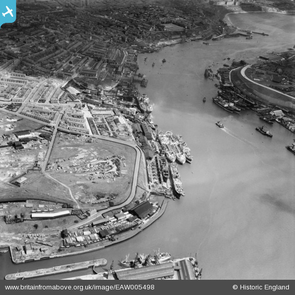
EAW005498 ENGLAND (1947). Smith's Docks and the Bull Ring Graving Docks alongside Shields Harbour, North Shields, 1947
© Hawlfraint cyfranwyr OpenStreetMap a thrwyddedwyd gan yr OpenStreetMap Foundation. 2024. Trwyddedir y gartograffeg fel CC BY-SA.
Delweddau cyfagos (8)
EAW005498

EAW005504

EAW005503

EAW005502

EAW005501

EAW005499

EAW005500

EPW019844

Manylion
| Pennawd | [EAW005498] Smith's Docks and the Bull Ring Graving Docks alongside Shields Harbour, North Shields, 1947 |
| Cyfeirnod | EAW005498 |
| Dyddiad | 15-May-1947 |
| Dolen | |
| Enw lle | NORTH SHIELDS |
| Plwyf | |
| Ardal | |
| Gwlad | ENGLAND |
| Dwyreiniad / Gogleddiad | 435515, 567377 |
| Hydred / Lledred | -1.4447536443576, 54.999626313424 |
| Cyfeirnod Grid Cenedlaethol | NZ355674 |
Pinnau
 redmist |
Thursday 23rd of November 2023 04:10:07 PM | |
redmist |
Friday 22nd of November 2019 07:22:19 PM | |
redmist |
Thursday 2nd of May 2019 11:40:46 PM | |
redmist |
Thursday 2nd of May 2019 11:33:24 PM |


