
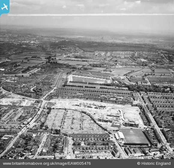
EAW005476 ENGLAND (1947). Higham Hill Common Allotments, the Green Pond Road Football Ground and construction of the Priory Court Estate, Walthamstow, from the west, 1947. This image was marked by Aerofilms Ltd for photo editing.
© Hawlfraint cyfranwyr OpenStreetMap a thrwyddedwyd gan yr OpenStreetMap Foundation. 2024. Trwyddedir y gartograffeg fel CC BY-SA.
Delweddau cyfagos (10)
EAW005476

EAW005475

EAW005470

EAW005474

EAW005468

EAW005478

EAW005469

EAW005471

EAW005477

EAW005473

Manylion
| Pennawd | [EAW005476] Higham Hill Common Allotments, the Green Pond Road Football Ground and construction of the Priory Court Estate, Walthamstow, from the west, 1947. This image was marked by Aerofilms Ltd for photo editing. |
| Cyfeirnod | EAW005476 |
| Dyddiad | May-1947 |
| Dolen | |
| Enw lle | WALTHAMSTOW |
| Plwyf | |
| Ardal | |
| Gwlad | ENGLAND |
| Dwyreiniad / Gogleddiad | 536682, 190185 |
| Hydred / Lledred | -0.026564638189957, 51.593436991975 |
| Cyfeirnod Grid Cenedlaethol | TQ367902 |
Pinnau
 redmist |
Wednesday 3rd of November 2021 03:57:08 PM | |
Eddy |
Thursday 21st of October 2021 09:06:42 PM | |
Eddy |
Thursday 21st of October 2021 09:05:40 PM | |
Michael |
Sunday 27th of April 2014 08:36:37 PM |


