
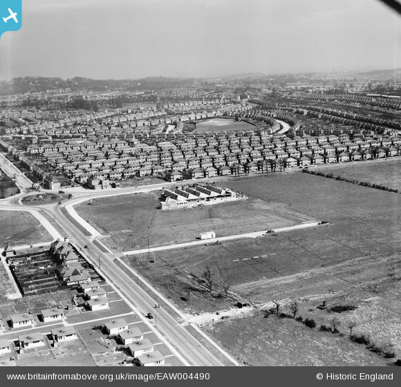
EAW004490 ENGLAND (1947). Victoria Road and housing estate to the south of Eastcote Lane, South Ruislip, from the west, 1947
© Hawlfraint cyfranwyr OpenStreetMap a thrwyddedwyd gan yr OpenStreetMap Foundation. 2024. Trwyddedir y gartograffeg fel CC BY-SA.
Delweddau cyfagos (2)
EAW004490

EAW004489

Manylion
| Pennawd | [EAW004490] Victoria Road and housing estate to the south of Eastcote Lane, South Ruislip, from the west, 1947 |
| Cyfeirnod | EAW004490 |
| Dyddiad | 14-April-1947 |
| Dolen | |
| Enw lle | SOUTH RUISLIP |
| Plwyf | |
| Ardal | |
| Gwlad | ENGLAND |
| Dwyreiniad / Gogleddiad | 512127, 185513 |
| Hydred / Lledred | -0.38241627826614, 51.556865245651 |
| Cyfeirnod Grid Cenedlaethol | TQ121855 |
Pinnau
 alec |
Monday 24th of August 2020 02:25:20 AM | |
mick |
Friday 27th of March 2020 06:42:59 AM | |
The Laird |
Saturday 15th of October 2016 07:37:26 PM | |
The Laird |
Friday 4th of March 2016 01:17:46 AM | |
The Laird |
Friday 4th of March 2016 01:12:41 AM | |
The Laird |
Thursday 3rd of March 2016 06:18:14 PM | |
The Laird |
Wednesday 29th of April 2015 04:17:19 PM | |
The Laird |
Wednesday 29th of April 2015 04:15:47 PM |


