
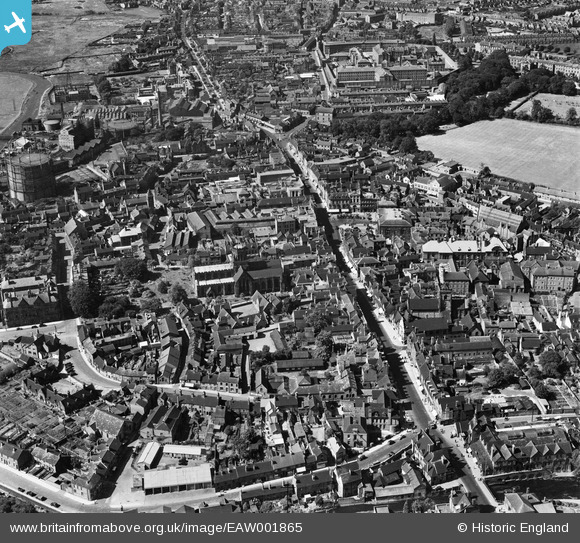
EAW001865 ENGLAND (1946). St Mary's Church, Greengate Street and the town centre, Stafford, 1946
© Hawlfraint cyfranwyr OpenStreetMap a thrwyddedwyd gan yr OpenStreetMap Foundation. 2024. Trwyddedir y gartograffeg fel CC BY-SA.
Delweddau cyfagos (18)
EAW001865

EAW001866

EAW024958

EPW014109

EPW014106

EPW053381

EPW053380

EAW024955

EPW053375

EPW034022

EAW024954

EAW001867

EPW014113

EPW020050

EAW046078

EAW024957

EPW017027

EAW024968

Manylion
| Pennawd | [EAW001865] St Mary's Church, Greengate Street and the town centre, Stafford, 1946 |
| Cyfeirnod | EAW001865 |
| Dyddiad | 12-July-1946 |
| Dolen | |
| Enw lle | STAFFORD |
| Plwyf | |
| Ardal | |
| Gwlad | ENGLAND |
| Dwyreiniad / Gogleddiad | 392159, 323241 |
| Hydred / Lledred | -2.1163287884815, 52.806332441245 |
| Cyfeirnod Grid Cenedlaethol | SJ922232 |
Pinnau
 Sparky |
Tuesday 19th of September 2017 10:04:57 PM | |
Sparky |
Tuesday 19th of September 2017 10:03:45 PM | |
AJ |
Tuesday 17th of December 2013 11:04:45 PM |


