
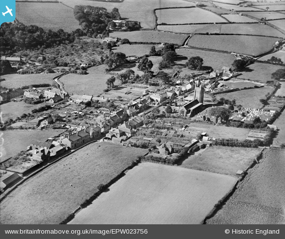
EPW023756 ENGLAND (1928). All Saints' Church and environs, West Alvington, 1928
© Copyright OpenStreetMap contributors and licensed by the OpenStreetMap Foundation. 2024. Cartography is licensed as CC BY-SA.
Details
| Title | [EPW023756] All Saints' Church and environs, West Alvington, 1928 |
| Reference | EPW023756 |
| Date | September-1928 |
| Link | |
| Place name | WEST ALVINGTON |
| Parish | WEST ALVINGTON |
| District | |
| Country | ENGLAND |
| Easting / Northing | 272412, 43839 |
| Longitude / Latitude | -3.7909371335809, 50.280088141423 |
| National Grid Reference | SX724438 |
Pins
Be the first to add a comment to this image!


